14

The importance of knowing your way around

Sorry this is such a long post.  The idea was inspired by a recent thread about roads vs interstates, and then again in a thread about cost-free preps.  It got so long and specific it felt like it should be its own topic…

One incredibly important aspect of prepping, in my opinion, is becoming keenly familiar with the road and highway system in one’s town and region. Too often people rely on their phones and navigation devices to get them from point A to B, and it seems to me a real, yet avoidable, vulnerability. While such devices can be great for avoiding traffic jams and road closures, it’s a real fool’s errand to rely on them completely. Networks can fail or get overloaded, devices/batteries can die, and it wastes time to type in/search for your destination – all things you want to avoid during an emergency.

An important (and free!) prep is getting to know your way around your immediate area and region. Knowing how to get yourself to nearby hospitals, your bug-out location, or simply out of town – without having to reference a map or a device – is a crucial prepping skill. Once you have those routes memorized, then work on a secondary route, and perhaps a third, recognizing that roads/passes/bridges could become un-passable and require you to take an alternative route.

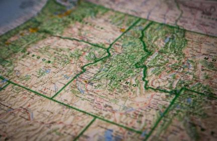
From there, getting to know your area’s transportation system is vital. Highway systems are called “systems” for a reason, and while they might not always make obvious sense, upon studying them they reveal themselves. Additionally, there are all sorts of embedded codes one can learn to aid this process (for instance, with the US Interstate System, odd numbered highways always go north/south, while even numbers go east/west (this is a pretty well-known example, but these sorts of codes go much, much deeper). The road and highway numbering system in the US can be extremely useful once you understand it. The same can be said for most urban grids as well, though those vary town to town and are much harder to memorize beyond your immediate region. There are several websites and resources that shed light on these systems, but here’s a good place to start: https://www.fhwa.dot.gov/programadmin/interstate.cfm

Another important thing to understand is the natural geography and barriers that inhibit our road system.  Rivers, bodies of water, mountains, etc, play a significant role in how we get around, making bridges and mountain passes natural chokepoints that can bottleneck traffic.  Recognizing these chokepoints is vital when making decisions, especially when evacuating an area.  For instance, if you are trying to get from Oregon into the state of Washington, or vice versa, you will have to go over one of nine bridges over the Columbia River spread out over 300 hundred miles.  Knowing where all nine of those bridges are, and the distance between them is vital if one hopes to make good decisions in case the preferred route becomes inaccessible due to structural failure or impossible gridlock.

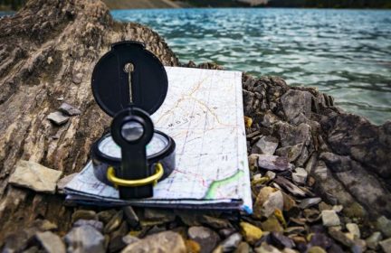
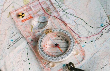
I highly encourage anyone who imagines needing to flee a disaster to spend some good time studying maps and trying to memorize the road system of their area.  Accompany this with going for day trips to test your knowledge (and do some exploring, which is fun!).  While out, try not to look at maps too much, or if you do only use paper maps and a compass (no devices!).  Familiarize yourself with landmarks, and try to keep tabs of your internal compass (ask yourself periodically “which way is N/S/E/W?” and try to keep tabs on that).  If you get lost try to figure it out, it can be fun with the right attitude, and you just might find your new favorite place.

Our GPS navigation devices can be great tools, but don’t allow them to inhibit you from forming a true understanding of your surroundings. Be ready and familiar with paper maps and analog navigation tools, but challenge yourself to committ as much to memory as possible.  If you are fleeing a hurricane, or rushing your kid to the ER, relying on your digital navigation devices could slow you down and do more harm than good.  

11

  • Comments (11)

    • 8

      A valuable website…Thank you; I’m going back to spending some more time on it.

      • 8

        I’m glad you enjoying the website Bob. I’ve enjoyed reading all of your forum threads and posts. You’ve been a great contribution to the wealth of knowledge on here.

      • 6

        Bob, another great resource is wikipedia, but more specifically pages about particular roads or highways you might be interested in.  Understanding the difference between state roads, US highways/routes, and the Interstate (by differences I mean numbering systems, signage symbolism, and such). 

        For instance, if you are a super nerd like me, you could easily spend a couple hours reading about US Route 30, coming to understand the original road and its functions, where it went, and how the construction of the Interstate system affected it.  It sheds a great deal of light on both the national transportation system but also the local.  For instance, if you are in the middle of Portland Oregon driving down Sandy Boulevard, you might not pay too much attention to the signs noting that you are on US Route 30, but if you did, and you had done your homework, you’d know that if you kept following Route 30 you’d eventually make it to Atlantic City New Jersey!

        https://en.wikipedia.org/wiki/U.S._Route_30

      • 5

        Good morning Matthew,

        (I’m up for the day of Thursday.)

        Yes, am like you; a quick check on a road could be a couple of hours.

        My “headache” is when a major state route designated, for example, as “East” after the route number but road actually, in geographical terms, is Southeast, and overall, it goes southward. 

        Must mention that checking on a road with a connecting vehicle ferry means up to half a day of my justified research.  Call it the historian in me. 

    • 6

      This is so smart and on point. I’ve spent most of my life in just two cities (both of which I lived in before I learned to drive, and for a decade+ before I bought my first smart phone), but moved to another state a little over a year ago, and it’s really made me appreciate how much more difficult it is to get oriented to a new place when you’re zooming around in a car and have a hand-held computer telling you where to turn all the time. I spent most of the first six months feeling just completely stupid on a daily basis because my sense of direction had been obliterated.

      Weekend getaways to surrounding nature have slowly helped me learn the highway system and the geography, and I’ve started challenging myself to go places I’ve been once or twice before without nav. To learn the city itself, I make an effort to run in a new part of town each day, which has helped— especially since I either leave my phone or keep it in a pocket where I can’t look at it. Sometimes my partner and I jump in the car and go walk the dog someplace new, too.

      • 8

        That’s a great strategy to challenge yourself to go places without your navigation. In some cities that can be easy, and others are laid out so horribly that it would be very difficult.  

        I’ve been working on my orienteering a little bit and try and guess if I am going N,E,S, or W, then I look at my car’s built in compass to verify if i’m correct or not. I’m asking Santa this year for a watch with a built in digital compass that was recommended from our Best survival watch article. Hopefully that will aid me in my navigation practice.

      • 9

        Indeed, navigation devices truly impede our ability to understand the geography around us.  Road systems have so many built in codes that, if we know them, can get us to where we need to be.  Each city is a little different, but once you crack the code you can really start to figure things out.  

        I lived in Portland for over 20 years and pretty much had the city memorized.  It almost became a parlor trick – throw an address at me and I could likely tell you were it was, or at least the general vicinity.  I recently moved to Spokane and have been trying to memorize it, but I’m not quite there yet.  I never use navigation devices, I’ll look an address up on a map, but then force myself to get there without a robot voice telling me when and where to turn.  Sure I’ve gotten lost a couple times, but getting lost is exactly how you learn a place.  You can find some interesting places when you get lost!

        And spending time simply studying Google Maps is incredibly beneficial.  Challenge yourself to draw a map of your area by memory -start with your immediate neighborhood and expand from there.  Soon you will have no need for any navigation devices!!!

    • 5

      I’ll expand on this and suggest the importance of getting to know any area you plan to bug out to. Learning the location of game or fire trails, water courses, minor vehicle tracks etc.  In my opinion it is better to learn the area before your life depends on it. 

      • 5

        Excellent point! Sometimes I just sit on Google maps satellite mode and run different scenarios in my head of how I would bug out, which roads would I take, what does my bug out location look like from above, how could I fortify and defend it against bad guys, etc…

      • 8

        Absolutely!  In addition to Google Maps, apps like All Trails and/or Gaia are fantastic for trails and off-road paths.  Definitely better to learn before your life depends on it, and actually a fun thing to learn and explore!

      • 6

        Thank you for the suggested apps matthew. I’ll have to check them out!