Hikers caught in a wildfire
Hi all,
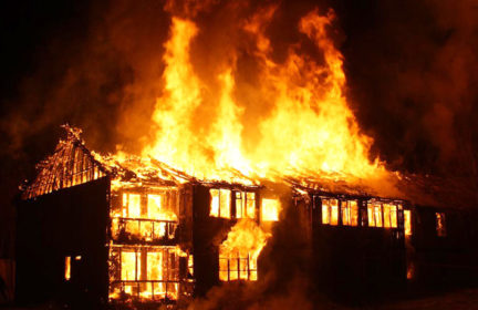
Came across this article about how two hikers that got caught in a wildfire survived (no pay wall) and thought some of y’all might be interested: https://www.khq.com/news/hikers-stranded-atop-mountain-by-bolt-creek-fire/article_d6cc054e-322e-11ed-9165-231473ca123d.html
They assumed the smoke was coming from the other side of the mountains. They weren’t able to be evacuated by first responders, came close to the fire several times, ran out of water, and nearly fell of a cliff, but were ultimately able to find their car and evacuate. I’m curious what, if any, different choices or preparations you might have made? I’d have avoided going outside in smoke full stop (it’s thick enough to coat my yard in ash, and I’m several towns over!) and would have checked the fire map (again, thick smoke).
-
Comments (21)
-
 Eric
- September 12, 2022
Eric
- September 12, 2022
Congrats to both of them for making it out of a bad situation. And for having the courage to share their story which they knew would lead to a lot of criticism. Now for the criticism…
After smelling smoke, they should have at least checked the location of the nearest wildfire. I use the MyRadar app on my phone to do this. If their location had insufficient bandwidth to use such apps, they could have called a friend and asked them to check on their behalf.
Another mistake they made was to put too much of their effort into this video when their lives were on the line. I would have remained focused on survival, not on selfies.
How could they be so thirsty when carrying such large backpacks? Did those backpacks really not contain water or anything else that could help them in a survival situation? Firstly, that’s a huge mistake in choosing gear. Second, if the gear isn’t going to help them, it should be dropped so that it doesn’t weigh them down.
-
Kira
- September 12, 2022
I was shocked to hear they didn’t even check! Google Maps, the fire department’s social media, most news stations… there’s so many ways to find where fires are at.
My understanding was that they ran out of water which makes sense to me if they were caught hiking in that much smoke for hours. They may not have, though.
Good point re: recording being a distraction from moving.
Dropping gear is a good idea!! It wouldn’t occur to me in the moment, but it isn’t worth your life to lug that much around. Maybe they to worried they’d have to shelter for days?
-
Eric
- September 12, 2022
“My understanding was that they ran out of water which makes sense to me if they were caught hiking in that much smoke for hours.”
Yes, they ran out. They brought enough for the short hike they were planning. They ran out because the fire forced them to take a longer hike. I think carrying a bit more than they expected to need would have been good preparation for emergencies like this one.
“Dropping gear is a good idea!! It wouldn’t occur to me in the moment, but it isn’t worth your life to lug that much around. Maybe they to worried they’d have to shelter for days?”
Long-term shelter wasn’t a possibility. If the fire slowed down enough to allow camping, it would also allow SAR to promptly retrieve them. I think it just never occurred to them that they were *allowed* to drop gear. It’s against so many rules… Take good care of expensive equipment… Don’t litter…
If they were completely focused on the one thing that mattered, survival… And if they used their breaks to explore strategic options rather than filming… They would have acted differently.
-
-
Shaun
- September 12, 2022
They ran out of water. Dehydration leads to cognitive decline. I know it’s heavy.
One of them almost fell off a 200′ cliff. I don’t know how that could have been avoided other than staying well clear of the scree. I don’t believe they had climbing ropes.
Comms, GPS and online maps were critical to their self rescue. What would have happened if comms went down? Sat phone? I don’t know if they had one.
I returned last night from a 4 day weekend at a nice lake in a nearby state. I took the scenic route for much of the way along a winding, hilly 2 lane for about 70 miles. I had printed Google Map directions and was using the Apple Maps app too. There were several key turns (turn left to stay on Rt. X…) and yet both apps screwed up distances by a wide margin. Turn left in 3 miles turned out to be 14 miles. This happened several times and I had to stop to get the correct distances.
All of this could have been avoided with real paper maps. I didn’t have one for this state and after stopping at 5 gas stations and one Walmart I gave up – no one sells real maps. They have to be ordered online. I am ordering real maps for all adjoining states.
The big takeaway for me is this: if these 2 guys lost comms could they have successfully self rescued? They might have lost their phones or backpacks – no comms. The nearby cell towers could have burned – as happened in 2020 – no comms. Did they have topo maps?
-
hikermor
- September 12, 2022
Absolutely right about topos. I have used them for decades and always will.
It would have been better to check conditions before going out.
-
Kira
- September 12, 2022
They definitely didn’t sound like they were prepared to climb! It makes sense that they were desperate enough to do so, but that part scared me to death.
It didn’t sound like emergency services helped them that much? GPS also sounded less than helpful (might have misunderstood though). A satellite phone doesn’t seem like it would have helped them a ton, and maps would have even less input on where fire is at. Point taken re: their orientation and communication being vulnerable. In another scenario, that could have been the difference maker for them.
I’m so glad to hear topo maps still help on roads! One of my baby preps is a national road atlas in my car. I’ve never used it, but I’m sure glad it’s there.
-
Eric
- September 12, 2022
“They definitely didn’t sound like they were prepared to climb! It makes sense that they were desperate enough to do so, but that part scared me to death.”
I don’t think they actually went down any cliffs. They just needed to be careful not to fall off any that they were walking near.
Cliffs were mentioned twice. The first time was when one of them was sliding down a hill and almost fell off a cliff. The second time just briefly mentioned cliffs as one of their challenges, with far more emphasis on the long hikes. If they were actually going down cliff faces, that part of the challenge would get more than three words of subtle mention.
-
hikermor
- September 12, 2022
Emergency services are not guaranteed and thy can be suboptimal for a variety of reasons. Your most reliable assistance is you and your resources, which are right at hand.. Outside help may or may not b available.
We don’t what was in their packs, what they weighed, and whether or not that was a normal load for them. Assuming you know enough to carry useful stuff, discarding items only makes your situation worse
-
-
pnwsarahContributor
- September 13, 2022
Wow. Great topic, Kira— I definitely want to learn other people’s thoughts on this, as it is a huge concern of mine. We were dispersed camping in the North Cascades on Labor Day weekend 2020 (a.k.a. the PNW Smokepocalypse) and woke up at 11:30 to the smell of smoke wafting into our vehicle. We had no reception. There was one road in and one road out— and we were barreling down that road within about 6 minutes. It was an hour drive to enough of a signal to load fire info. Turns out, the smoke was from the far-away fires we already know about, and the shift in conditions was due to a change in wind direction— first of that east wind that would make everything so bad. I remember rolling up to a drive-through espresso hut in sick gray-yellow light at about 7 a.m. and just feeling like the backcountry would never be the same for me. I remember backpacking through Little Yosemite Valley in 2001 with my dad and getting ash. We knew where the fire was, and how it was expected to move. It never occurred to either of us that we weren’t safe. I wouldn’t feel that way now.
But, back to the subject at hand: The most surprising thing about this story, to me, is that they had as much connectivity as they did. We’re in the mountains a lot; whether or not we have cell service for any substantial portion of our hike/ski (let alone the ability to load a fire map on a browser) is a coin toss. Super lucky that they could just call 9-1-1 and talk to someone. So yes, of course, check the fire map BEFORE you go, and ideally right before you lose service, but the way things are these days that’s not a guarantee that you’re safe for your outing, esp. if you’re staying out overnight. I think I’m at a point where I’m just not going to do this kind of thing if the conditions are such that a fire would move quickly and dangerously if it started (e.g., strong wind from the east), but I also don’t know how easy that is to predict…
-
Eric
- September 13, 2022
If I spent a lot of time hiking/camping out of cell range, I’d at least consider getting satellite communication such as Garmin Inreach. They’re supposed to provide reliable texting, GPS, and topographic maps anywhere in the world. Then just ask a trusted person back home to send you a message if there’s a wildfire in the wrong area.
(There should be an automated service to replace that “trusted person” but I don’t know of one.)
-
pnwsarahContributor
- September 14, 2022
Thanks for that suggestion, Eric. I was thinking last summer (as my husband squeezes our adventuremobile through some very thick vegetation on a backroad off a backroad off a backroad in BC) that I should look into Inreach and similar products/services to get a sense of what the options are and maybe invest in one, but it slipped my mind and I didn’t follow up. I feel like this would be a great thing for TP to treat in a review (if they haven’t already… I don’t think they have…), but if someone in the community has done a deep dive (or even started a dive and could start a thread others would hop onto to to add their thoughts/experiences) that could be great, too.
-
Alicia
- September 14, 2022
I checked into this a little as emergency communications because the topography around my home and work make comms without power and cell reception a challenge. Ham radios don’t make it across the steep mountain foothills at the tens of miles distances. Satellite direct for anything is really pricey. Gideon mentioned that the just announced Apple iPhone 14 has a direct satellite SOS message option (free for 2 years). I read a bit more about it and they’ve helped by compressing the text message and also staffed a call center for coverage areas that don’t support texting. I’m hoping this means that Apple is aiming to offer satellite texting as a service option in a few years joining in the Garmin Inreach or Somewhere Global Hotspot markets. The Somewhere global hotspot crossed The Prepared’s forum thread at some point.
-
Eric
- September 15, 2022
Regarding Garmin Inreach, I haven’t used myself but have seen endorsements from other TP members. For example, NazSMD, AndyO, and BWO all speak highly of their Garmin Inreaches in this discussion. I’ve not seen any TP members express regret about getting an Inreach.
https://theprepared.com/forum/thread/had-a-road-trip-felt-very-unprepared/
-
Alicia
- September 19, 2022
I think that’s because they go off grid at least occasionally – and so had a ‘normal life’ reason to invest, not only disaster prep. But I may also be projecting my perspective here. My primary use case is comms insurance for an earthquake or fire induced communication outage or loss of performance due to overload. In a perfect outcome, it is never used for real, only tested.
To really cover my communication risks, I would need two units with two subscriptions. That’s $800 in hardware and $288/year respectively for Garmin – but it’s stand alone with nothing else needed. Other options are a hotspot that requires a smartphone app interface: Zoleo is $400 in hardware and $480/year for two; Somewhere Labs global hotspot is $TBD (currently waitlisted – had been $300 IIRC) in hardware and $199/year for two. Somewhere Labs is what I was considering and I think both they and Garmin have created a lesser plan option since I last checked into this. If satellite texting actually becomes a capability in a smartphone, the hardware cost is already made (and likely higher for this feature) and is something already carried/managed by both of us.
-
Eric
- September 19, 2022
“If satellite texting actually becomes a capability in a smartphone, the hardware cost is already made (and likely higher for this feature)”
All of the iPhone 14 models include satellite connectivity at no additional charge for the first two years. iPhones were always expensive ($799) but this is the same price used for the previous model when it first came out. The only supported features for now are location sharing and emergency texting. I imagine they’ll offer subscriptions later to either extend those two features beyond two years or to include non-emergency texting.
-
Alicia
- September 19, 2022
Sorry for not being clearer. I had read the iPhone 14 site. What I meant by “higher for this feature” is compared to lower or still available to purchase older models and other brand smartphones without it. The 14 is about $200-$400 more than my trade in right now – so about the same or lots more without a trade-in to getting the other hardware. The Apple satellite connectivity is SOS texting to emergency services only, not to another user. (Clarifying your emergency texting term). I used the term satellite texting because I want to text my family in an emergency which is what these other options currently offer for a premium. I am hoping, as you say, after the 2 years when Apple starts charging for the service, it would include this capability. For an emergency use, that would mean service plans that are a lower monthly fee with a per text charge, versus a higher monthly fee with 10+ included texts which I’ll hopefully never use.
-
Kira
- September 14, 2022
Ah, smokepocalypse! I remember that well, haha.
That’s terrifying!! I’m so glad you were safe. Better safe than sorry, though. It’s interesting to hear that this is a lot different from even a couple decades ago. I’m old enough to remember before fires were this bad, but not old enough to have done any real hiking before them.
Agreed re: connectivity. I lose reception around the foothills. No way I could call for help from the mountains.
Sadly, I think you’re right. I’d go on a day hike with fire hazards after checking a map, but I’d be so nervous on a multi day trip with a high risk of fire that it wouldn’t be worth it to me.
-
pnwsarahContributor
- September 14, 2022
Sadly, I think you’re right. I’d go on a day hike with fire hazards after checking a map, but I’d be so nervous on a multi day trip with a high risk of fire that it wouldn’t be worth it to me.
Yepppppp. This. Exactly. Unfortunately. I did a lot of backpacking in HS/college. Fell out of it when I discovered running/my workload got heavier/all my gear got destroyed in grad school, but I just can’t stomach the thought of going back to it now, past June-ish, depending on drought conditions and wind forecast.
-
Alicia
- September 14, 2022
I get this, Kira and Pnwsarah. I had a friend return from a backpacking trip last year to the California border with Oregon. They could smell smoke, and learned that the fire was ‘over there about 20 miles’ which wasn’t far enough away in my book. If you’re driving 20 miles between fires (there were two IIRC), that is too close – they can move fast and change direction quickly. And mountain roads are circuitous. Seemed crazy to me to take such risks for what, really?
-
-
Bigwig
- September 17, 2022
I just watched Fire in Paradise on Nexflix and was going to post a question around preparations for wildfires.
-
Eric
- September 17, 2022
Here’s the discussion about that video (and another that I also recommend on the same event):
And here’s a guide for wildfire safety:
https://theprepared.com/emergencies/guides/wildfire/
That’s just a start. There’s lots more material about wildfires. Several of our top contributors have experience with wildfires and how to prepare for them.
-
-
- Whats going on with this site - 2 months ago
- Mylar Bags - February 27, 2026
- Shot Show 2026 recap - January 22, 2026
- News for the Week 2026-1-12 - January 12, 2026
- News for the Week 2026-01-05 - January 5, 2026
This forum is heavily moderated to keep things valuable to as many people as possible. Full community policies are here. The basics:
- 1. Be nice to each other.
- 2. Stay focused on prepping.
- 3. Avoid politics, religion, and other arguments.
- 4. No unfounded conspiracies, fake news, etc.
- 5. Debate ideas, not people.