Brushfire information resources
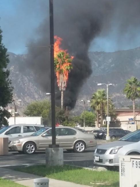
A brushfire started very near my home this afternoon while I was at work. Luckily, a neighbor was home and alerted me. I am fortunate enough to have the flexibility to return home, work from there and monitor the situation. I have Fire Department alerts to email but don’t check my personal email often during the workday. No other alert was raised as evacuations have not been declared yet. So I have some work to get better alerts. In a couple hours the fire went from 5 to 107 acres and had the wind stayed in its original direction, an evacuation would have been more likely for my neighborhood. But luck was on our side today, and the wind changed to away from homes. There are 4 helicopters and I don’t know how many firefighters. It’s looking like they’re succeeding in containment based on the reduction in smoke and frequency of helicopter flyovers.
These resources were quite helpful in assessing the fire as it had not yet made the news:
- Local Fire Department alerts – once I heard, I could check my email and see a map pin that was near (but also from experience not ON) the fire location.
- Satellite map of potential fires – zoom to your location. The squares grew over time.
- Live tracking of aircraft website. If you click on a helicopter it will show the recent flight path. That showed the water pickup to dump location loop. Quite helpful.
- Live tracking of wind direction website – indicates the direction the fire may move.
- MyRadar phone app. @eric has shared this for fires. For this event, it’s not showing this fire, or it’s in the wrong spot.
This appears to have been a near miss for me so far. And an opportunity to learn how to be better prepared for next time.
-
Comments (9)
-

